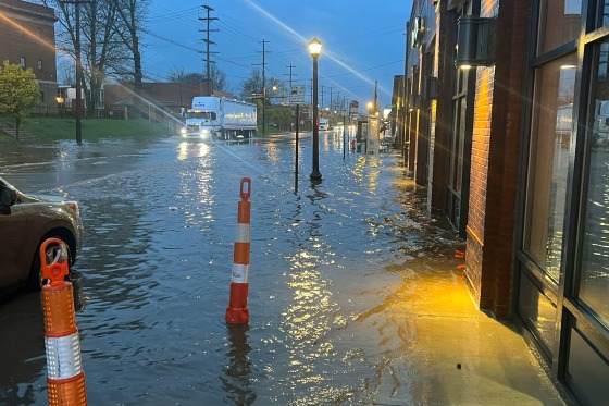
A dangerous storm system that is bringing torrential rain, the possibility of localized tornadoes, and snow to sections of the Ohio Valley region and the Northeast has millions of people under weather alerts. With many rounds of storms predicted for the day and into the evening, there is a chance of severe weather across the Ohio Valley, middle Tennessee, and the Southeast on Tuesday.
A Tornado Watch In Ohio
A storm is already battering the Ohio Valley region. Up to 4 million people are under a tornado watch that is in effect until noon ET along the Ohio River. Some of these storms may have straight-line winds of 90 mph. 54 million people are at risk due to a notable outbreak of severe storms that is extending from the Great Lakes to the Gulf Coast.
According to the local station NBC26, a winter storm warning has been issued for Wisconsin, effective from 1 p.m. on Tuesday until 1 p.m. on Wednesday. According to the prediction, there will be a lot of wet, heavy snowfall during the next 24 hours, along with wind gusts up to 40 mph and slick roads. As the storm moves through, snow will persist through Thursday in northeast Wisconsin before clearing out on Friday to reveal bright skies.
Ohio NBC Station Issues Warning
In central Indiana and Ohio, there is a risk of hail and strong winds. The weather service issued a warning, stating that tornadoes may be brought to Indiana by the storms. According to Columbus, Ohio’s NBC station, WCMH-TV, there is a remote risk of tornadoes in the area.

With 16 million people from Illinois to Pennsylvania under flood watches on Tuesday, flooding is a serious threat.
The Ohio Valley will have heavy thunderstorms sweeping across it on Tuesday, which will pose the greatest risk of flooding. One to two inches of rain per hour could cause flash flooding.
The Weather Prediction Center warned of a moderate danger of excessive rainfall through Wednesday morning over portions of the lower Great Lakes, the Ohio and Tennessee valleys, and the central Appalachians due to the heavy rain. Localized flash floods due to the wet weather is expected, with highways, small streams, and urban areas being the most susceptible.
Danger Lurks In Florida And The Mid-Atlantic
In Florida and the mid-Atlantic, 15 million people might be in danger of severe storms on Wednesday.
According to the center, the Northeast could get heavy, wet precipitation and possibly sleet from Wednesday afternoon through Friday due to a secondary low-pressure system around the mid-Atlantic coast.
Significant snow accumulations are to be expected in Upstate New York and northern New England, which could make travel dangerous due to poor visibility and snow-covered roadways.
Additionally, from Wednesday into Thursday morning, there was a minor chance of severe thunderstorms over the Florida Peninsula, according to the center. According to the report, there could be tornadoes, strong wind gusts, hail, and frequent lighting during the storm.
The springtime storms come after a rainy Monday that left sections of the South hammered by heavy rain, hail, high winds, and possibly even tornadoes.
Follow Us:
Youtube | Google News |
Igniteds is on YouTube; click here to subscribe for the latest videos and updates.


